Sandhall Ponds: Directions
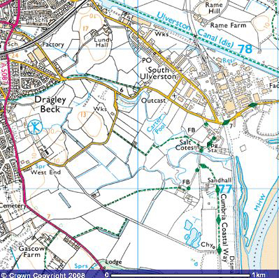
Image produced from the Ordnance Survey Get-a-map service. Image reproduced with
kind permission of Ordnance Survey and Ordnance Survey of Northern Ireland.
|
View Larger Map
|
Directions to Sandhall Ponds from the M6 Motorway
From the M6 Motorway Take Junction 36 following the A590 and signs to Barrow-in-Furness.
Upon reaching Ulverston you will pass Hoad Hill with the John Barrow Monument on
the top. When you arrive at Ulverston you will come to a mini roundabout with a
Booths supermarket to your left. Go straight on at this roundabout and take the
second left (just after the pelican crossing) turning on to Quebec Street (A5078)
and follow the signs for Bardsea. Carry on along the A5087 for about 1/2 mile, when
you pass the Ulverston Outdoor Leisure Centre take the next turning on your left
past the Swimming Baths onto West End Lane. After approximately 200 yards take the
first sharp right onto Brick Kiln Lane and follow this lane for about 1/2 a mile
and you will see Sandhall Ponds appear to your left.
Parking at Sandhall Ponds
There is limited parking for about 6 cars at the roadside.